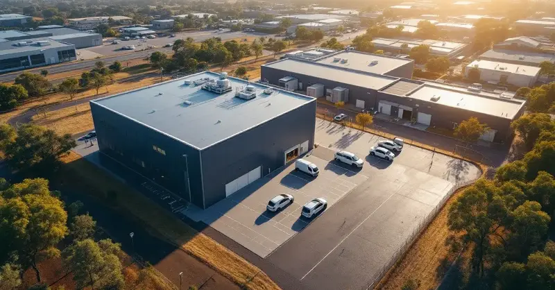
A new clean room facility at Edith Cowan University’s School of Engineering is expected to strengthen Western Australia’s capacity to design and assemble satellites locally. Developed through collaboration between the university, LatConnect 60 (LC60) and the Western Australian Government, the facility supports the integration of Low Earth Orbit satellites and advanced optical payloads. According to details published by SmartSat CRC, the project reflects growing investment in sovereign space capability and advanced manufacturing in Australia.
Purpose-built infrastructure for satellite integration
The clean room has been purpose-built to support the assembly, testing and integration of sensitive satellite systems. Designed as a Class 1000 clean room, it can operate at Class 100 conditions when required, enabling the handling of delicate optical components and electronics used in space missions.
The facility was funded in part through a S$3.5 million contribution from the Western Australian Government’s Investment Attraction Fund in 2024, matched by investment from LC60. The initiative reflects broader national efforts to strengthen advanced manufacturing capability and defence technology supply chains, similar to initiatives highlighted in Australia’s advanced manufacturing grants supporting defence innovation.
Beyond infrastructure, the clean room will serve as a teaching and research platform. Students and researchers will have opportunities to work on practical aerospace engineering projects while collaborating with industry partners involved in satellite manufacturing and Earth Observation systems.
Supporting Australia’s growing Earth Observation capability
The facility is expected to support the development of new satellites designed for applications including environmental monitoring, agriculture, disaster management and national security. Earth Observation technologies are increasingly used to monitor crop health, track emissions such as methane and carbon dioxide, and support emergency response activities.
LC60 is currently developing two satellites equipped with short-wave infrared (SWIR) sensors, with support from both the Western Australian Government and the Australian Space Agency. These sensors enable high-resolution detection of environmental changes, including bushfires, atmospheric gases and land-use patterns.
Research collaboration is also underway with NASA’s Marshall Space Flight Center on SWIR technologies aimed at improving bushfire detection. Such partnerships highlight how Australian research institutions are contributing to global space science while strengthening domestic technological capability.
AI-driven data platforms and integrated analytics
Satellite manufacturing represents only one component of LC60’s broader strategy. The company is developing an integrated system that combines satellite infrastructure, data access and artificial intelligence-enabled analytics. Its EONet60 platform aggregates more than 100 different data types into a unified operational picture using AI-based data fusion.
The platform has already been used to support emergency response operations, including rapid satellite imaging during Cyclone Narelle in collaboration with Landgate and Western Australia’s Department of Fire and Emergency Services. In that instance, imagery was processed and delivered in around 90 minutes, enabling faster situational awareness during disaster response.
The integration of AI with advanced manufacturing and sensor technologies is becoming increasingly common across Australian industry. Comparable digital transformation efforts can be seen in projects such as AI-enabled manufacturing platforms used in medical device production, where data-driven processes are improving design and production efficiency.
Long-term satellite deployment plans
LC60 has outlined a phased satellite deployment strategy beginning with two satellites, followed by constellations of nine and eventually 18 spacecraft. The company has indicated longer-term ambitions to manufacture between 50 and 100 satellites in Western Australia as the sector expands.
Industry analysis cited at the launch suggests that the Asia-Pacific Earth Observation market could reach approximately US$315 billion by 2030. However, growth has been constrained by fragmented supply chains and limited availability of high-resolution SWIR data, an area where new satellite systems may fill emerging market gaps.
Speakers at the facility launch emphasised that sovereign satellite infrastructure and trusted data pathways will be increasingly important as Australia expands its capabilities in environmental monitoring, disaster management and defence-related space technologies.
This article is created with the assistance of OpenGov AI.